Ballarayanadurga


Location: Charmadi Ghats connect the western part of Dakshina Kannada district to Chikmagalur district and the prominent highway is connecting Ujire (9 kms from Dharmasthala) to Kottigehara (about 50 kms from Chikmagalur). Ballarayanadurga is a fort atop a hill located about 10 kms from Sunkasale, on the Kottigehara - Kalasa route.
Route: Ballarayanadurga would be around 325 kms from Bangalore. The route to take would be Bangalore - Hassan (190 kms) - Belur - Chikmagalur (250 kms) - Mudigere (280 kms) - Kottigehara (300 kms) - Sunkasale (315 kms). (About 7 kms from Kottigehara, you need to take a U turn towards your left - easy to miss the sign boards). At Sunkasale, the telecom office is to the left. Take the left immediately after that and follow the roads for about 8 kms through an estate to reach the trekking trail to the top.
The trek: The trek, as always, depends on the route you take. The easiest route would take about an hour to an hour and a half to the top and has no hassles. Depending on the pain you want to endure and the risks you want to take - choose the route you want!!! At the estate, you have to pass past the cow shed and walk up. A route to the right takes you in front of the peak and you have to essentially form your own path up. The easy route is by avoiding this and continuing on till a stream is reached. Now, proceed to the right of the stream up and around the hill and climb from the rear side.
Blah Blah Blah: A 10 day vacation for Diwali + Rajyotsava + Eid and plans for trekking in the Vindhyas was ditched for lack of company. An alternative plan for trekkin in Charmadi was almost scrapped for the same problems. However, the enthu of Sudarshan, Bhatta and yours truly prevailed. :)
"We'll leave by 0500 to avoid the morning traffic", Sudarshan had proclaimed. He made his appearence at 1100 (finally!!) and we set off - ripping thro Kunigal to reach Channarayapatna for a late lunch. Good roads saw us pass Hassan and reach Chikmagalur by 1700 hrs. A chai break later, we were refreshed enough to head towards Mudigere through some intermittent drizzle. We raided a bakery there, packed enough for breakfast the next day and embarked on a very very painful journey through the worst roads in the region to finally reach Kottigehara. Lots of refreshment here in the form of bajjis and maddur vadas :) ... Hogged on these and set off on nice winding roads towards Sunkasale.

"What an amazing curve" - This was the thought running through my head and the next thing I remember is skidding across the road - my bike generating sparks thanx to the contact between the crash guard and the ground - and wondering, "Wow!! When do I stop!!!!". It was a scary moment - a long fall! Amazingly, the only things damaged were the crash guard and the footrest of the bike and I had scraped the skin off my knee and elbow ... :( Helpful passers-by hammered the footrest back in place and I blooded a few wads of cotton before continuing on to Sunkasale - amazingly in one piece.
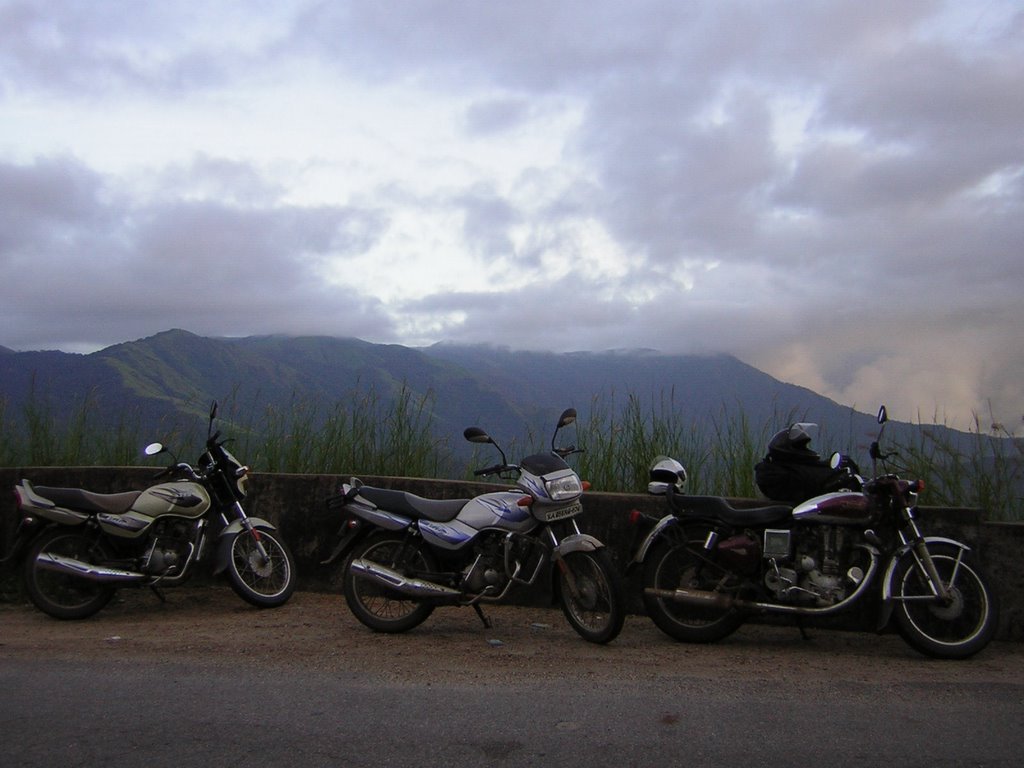
The good part of the accident was that the guys who helped me out were from Sunkasale itself and they talked some ppl into letting us stay at an estate which comes enroute the top of Ballarayanadurga. :). What better could we ask for!!! We rode up to the estate on our bikes and crashed for the night.
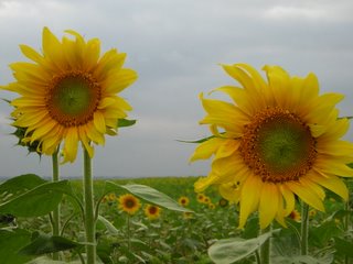
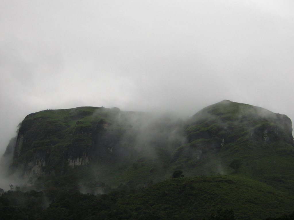
I woke up the next morning and took a stroll. As beautiful as any estate - on top of a hill - nice views around - a cool morning. I was enjoying it!!! The clouds cleared to reveal the magnificent picture-postcard above that was Ballarayanadurga!! It would compete against any Lohagad in the Vindhyas!!! I was estatic!! I ran in and woke the others up!!! (This seems to have become a habit!!!)

It was past 0900 when we were ready to leave. We found a cowherd who showed us the way to the top and promised us a tour at the top!! According to him, there was a hell lot to see up there and it was so good that we would refuse to get down! We proceeded calmly and reached the small stream, but couldnt find any route as such to take us to the top. We went back to the diversion and decided to take the peak head-on. The three of us were crazy enough to attempt climbing up the steepest slope of the hill and we looked damn happy doing it!!!!


One wrong step would have seen us fall a hundred feet and I almost did!! My feet searched for earth below the grass I stepped on only to realise that there was none there!!! I slipped down a cpla feet and thankfully caught a dead tree to break my slide!!! Had to be more careful then on!! We climbed further up and had our vision restricted to a few feet thanx to a thick mist which set in ..... We first had to climb up a 7 feet rock and then clear a 10 feet rock before we would celebrate our climb... and celebrate it we did!!! :) It was probably the scariest climb that we had done in the recent past sans any safety measures!!
All promises of a great view from Chikmagalur to Mangalore were unfulfilled - blame the thick mist for that!! But the experience of floating thro the mist is an unforgettable one by itself :). We took the easy way back and reached the estate by 0230 hrs!! The trek is actually from Ballarayanadurga to Bandaje Arbi which we couldnt attempt as the logistics of getting back to the bike from Bandaje was painful enough!! So we decided to get back to the estate, go on road to Bandaje and then climb there!!! :)
The distance by road is 70+ kms. Back to Kottigehara and the drive for abt 10 kms through the Charmadi ghats is arguably the best one can get in Karnataka. Amazing landscapes .. Great curves for biking .... Its like driving through a dream only shattered by the loud horns of approaching vehicles!!! :D

The trek up Bandaje Arbi??? Well .... Thats quite another story in itself!!!!
The trek up Bandaje Arbi??? Well .... Thats quite another story in itself!!!!
Bandaje Arbi


Location - Bandaje Arbi is located near Ujire (9 kms from Dharmasthala). The road approach is through Ujire towards Chikmagalur just before the Charmadi Ghat section begins at a place called Mundaje. A left turn at Mundaje and continue on that road for about 8 kms till a stone sign directs you to the right for Bandaje Arbi, 12 kms from the falls.
The trek approach is from Ballarayandurga ...... I mean, Ballarayandurga - Bandaje Arbi is a famous trek route.
The Trek - The trek route from the end of the jeep track is initially a bit confusing till you reach the last house!! (how on earth do u know if the house u c is the last one or not!!!). From there, the route up is fairly clear if your sense of direction is ok. An hours climb gets you to the stream (which is from the falls). You might cross two small streams if you go just after the rains! Cross them and continue climbing up for about a couple of hours. You would be climbing with the falls on your left side until you reach open 'grasslands' above the forest cover. This might be after you go to the back of the hill you are climbing and so the falls might be on your right now. Continue on this crossing small hills .... and you might reach Bandaje!!! Trust your ears too!! The roar is pretty audible if i may put it mildly!! :)


